Wednesday, June 12, 2013

Severe storms possible tomorrow. Derecho Tonight?

As seen above, a series of strong thunderstorms are currently forming near the Great Lakes region.  This series of storms, a Mesoscale Convective System (MCS) will have severe weather and could potentially spawn the feared derecho.  However, compared to last year, the CAPE (atmospheric potential energy) is significantly lower, so any derecho that forms in the Midwest is unlikely to impact the area and make it past the mountains. To answer the question posed in the title, derech-no would be a more accurate headline.   However, some potentially severe thunderstorms could impact the region late overnight, delivering strong winds and rains in the 1-4 am time range.

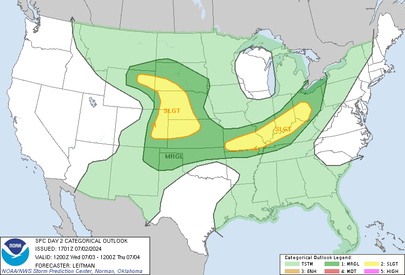
Now, moving on to tomorrow evening's severe weather potential, which also has a chance to give us some significant storms.
Yesterday, it seemed as if the Thursday evening storms could be a historical event, as there was a possibility for a strong (and strengthening) system to traverse over Southern Pennsylvania right after sunset. The timing and strength of this system combined with a particularly volatile air mass could have brought about some of the strongest storms that this area sees.  However, recent guidance suggests that the threat for such a strong event has decreased, as the storm now seems likely to arrive in the afternoon, before the sun has completely energized the atmosphere, with a weaker low pressure as well.  Nonetheless, the potential for strong and severe thunderstorms remains, but it is unlikely that they will impart significant damage on the scale of the derecho.

Tuesday, March 5, 2013

Winter Storm on Track, School Forecast

Storm Update

11 PM UPDATE: The temperatures are much lower than initially forecasted, and it seems as if we will get very little, if any rain. In addition, the storm is picking up intensity, and thundersnow is verypossible tomorrow morning.  This is supported by the latest forecast models.  I'm upping the storm totals to 8-16 inches, with 3-6 possible tonight alone.   
The winter storm is starting to make its way into the area, and while it may start out as a bit of drizzle, precipitation will quickly switch over to snow overnight. I'm sticking with my initial forecast of 6-12 inches, with more possible northwest and less southeast.  While the temperatures now are too warm for snow, in the lower 40s, the dew points are in the low twenties, so once precipitation starts, evaporative cooling in the atmosphere will allow snow to fall, relatively quickly after the onset of precipitation. 

School Prediction

At this point, it is almost a foregone conclusion that school will be closed tomorrow (Wednesday), as it will be snowing throughout the day, and at least 2-4 inches will have already fallen overnight.  I wouldn't be surprised if MCPS and other area school systems announced closings sometime tonight.  Since latest guidance suggests that the snow will taper off late Wednesday night, school will also probably closed Thursday, if everything goes according to plan.  Friday is more iffy, but a delay or even closing is not out of the realm of possibility. 

I'll post another update tomorrow morning as the snow starts to ramp up (hopefully).

Monday, March 4, 2013

Major Snowstorm to Impact Area Wednesday

A major and potentially crippling snowstorm seems all but certain to impact Washington D.C. on Wednesday. While temperatures will not be ideal, the heavy precipitation will cool the atmosphere enough for some significant snowfall in the area, the likes of which have not been seen for over two years.

Precipitation Details

The models are pretty much in consensus in forecasting 1.25-2" of precipitation to fall in the area.  IF accompanied with the 10:1 or 15:1 ratios that are often in January and February, we could be talking about one of the largest snowstorms in DC history.  However, due to temperatures that will hover around freezing the whole event, we will rather see ratios of around 7:1 or 8:1, and it is not out of the question that rain could mix in on Wednesday, which could drive down totals to the 3-6" range. However, this looks unlikely at the moment.  Still, this will be a very wet snow that could stick to the power lines and, combined with moderate winds, cause some power outages.

Timing

The first effects of the storm will be felt Tuesday evening, starting as light rain.  As it gets colder and temperatures fall overnight, it will start mixing and eventually switch over to all snow.  The snow will get heavier throughout the night, and will continue during the day Wednesday, until it tapers off Wednesday night.  It is also possible that some rain could mix in during the day Wednesday, but this seems unlikely, especially north and west of the District.

Impact

I would predict around 6-12 inches of snow throughout Montgomery Country, with 12 or more inches being more likely out west near Poolesville, with 6 or so inches more likely near Silver Spring. Along with this, schools have a very high chance of closing Wednesday, a good chance of closing Thursday, and may be delayed Friday.

UPDATE: Latest guidance suggests the possibility that the temperatures do not fall enough and that this is mostly rain, with a couple of inches of snow on the front and back end of the storm.  While unlikely, it is important to remember that this remains a possible scenario.

I'll post another blog update tomorrow afternoon, and minor updates on Twitter, where you can follow me @samdman95

Thursday, January 24, 2013

Light Snow Expected Tomorrow Night

The Alberta Clipper that rolled in last night brought a nice half inch of snow (along with an unexpected two hour delay), and more of the fluffy stuff is on the way for tomorrow evening into the night.

As I'm sure everyone has noticed, it has been downright frigid this week, and it will stay that way for tomorrow's little event, meaning that any precipitation will fall as snow.  While the wet snow that we're accustomed to in DC has 10:1 snow:liquid ratios, tomorrow's powdery dendrite flakes will lead to ratios somewhere around the 15:1 range, amplifying our snowfall total.

However, there really isn't much precipitation to help us out, as the NAM forecasting model (the most generous in terms of snow), only gives us .09 inches of precipitation, which would lead to a measly 1-1.5 inches of snow.   While I think a decent coating is likely, this storm could fizzle out into flurries. On the other hand, there is little possibility for this weak system to pick up steam, and anything more than 2-3 inches isn't happening.

Our recent storms have mildly overperformed their quite modest predictions, so I think about an inch of powdery snow is what we'll end up with Saturday morning.  While aesthetically pleasing, it will be the 730th day without two or more inches of snow, a drought that has been active since the storm on January 26, 2011.

Thursday, December 27, 2012

Some Snow Likely Saturday

A light dusting on Christmas Eve and a sloppy mix on Boxing Day were a good reminder that yes, it actually does snow in DC, despite seeing few flakes last year.  However, neither of these events delivered solid, accumulating snow, but by Saturday, that may change.
Two of the snowier possibilities

An area of low pressure is expected to bring precipitation to the area on Saturday, but exactly how much and what type has not yet been pinned down.  It is not a particularly strong system, and the temperatures will be right on the border, so anything from a light rain/snow mix to a nice fluffy 4 inches is possible.  
A more northerly track would lead to a very weak storm that would be mostly light rain throughout the day Sunday, with some flakes mixed in early.  However, a more southerly track and a stronger low pressure system would lead to a sustained light to moderate snowfall starting late Friday night and tapering off Sunday evening.  
At this point, the middle ground seems most likely:  a light snowfall of an inch or two with a bit of rain mixed in towards the end, especially south and in the District. That said, it's always colder up north near Damascus, and the cows there could see three or four inches of snow.
By no means a significant storm, this should be a nice snow to brighten up the break, and bigger things may be in store for next week, when a system makes its way up the coast.


Tuesday, October 30, 2012

Sandy Departing Area; Storm Recap

Sandy is leaving the area and the worst of the storm is over.  While the effects in the D.C. area are moderate, they are nowhere near the destruction in New York City.  There, gusts of up to 80 mph combined with a record storm surge lead to effects far greater than those seen in DC.  The subway flooded,  Lower Manhattan lost power, and FDR drive was inundated.

What was different here?  Mainly the storm surge.  Most of the damage in NYC was widespread flooding caused by the rising levels of the East River.  Manhattan is an island, DC isn't.  While the winds were stronger in NYC, the DC winds were only slightly overestimated, as widespread gusts were reported to reach or exceed 60 mph, including a 76 mph gust in Laytonsville, Montgomery County. The rains here were more significant than NYC, with 4-7 inches of rain being the norm throughout the area.  That said, the flooding from a 13 FOOT storm surge is much greater than that from 7 inches of rain.

So, where was all the destruction? Why wasn't this like the derecho? A combination of factors.  Firstly, the worst of the storm happened at around midnight, when most people were asleep. But, the main reason was actually because of the derecho. The summer storm already knocked down any loose limbs and weak trees, leaving few easy targets for Sandy.  In addition, the massive repairs after the derecho strengthened the power grid.  With this storm happening in late fall, there were fewer leaves on trees to pick up the gusts.  Just as a windmill with one small blade wouldn't spin as much, trees with fewer leaves will be less likely to fall due to wind.
While many in the DC area will view this storm as underperforming and forgettable, I'll chalk it up as a victory for PEPCO here, and in the Tri-State New York area, it will take time to heal from this disaster.


Monday, October 29, 2012

Sandy's Effects Starting to Ramp Up

Despite some premature calls that Sandy is merely a "breezy rainstorm", things are going to get serious overnight.  Winds that have been sustained at around 30 mph will almost double to around 55 mph, and gusts around 45 mph will approach 75.  Rains will intensify and be blown sideways by the wind Sandy is still over the sea, and will soon make landfall near Cape May, NJ, or the Delaware coast.  At this point, the location landfall doesn't matter, as the storm will trek west and park itself over the Mason-Dixon line, whipping us with intense winds all night.

The strong winds and rains will slowly decrease in the morning and could change to wet flurries as they depart.  However, the strong winds tonight are not something to be trifled with.  Stay inside; trees WILL fall, branches WILL turn into projectiles; and power lines WILL  snap.  I doubt that there will be school on Wednesday, and possibly even Thursday,  however, this will be largely dependent on power outages and other damage. I will try to post tomorrow with a recap of the storm, but that seems unlikely due to PEPCO.